| Camp Ground: | Fowlers Campground, CA. |
| Total Total Distance traveled: | 506 Miles. |
| Distance Traveled today: | 63 Miles. |
| Day Highlights: | 10K Run or walk from Lower to Upper McCloud falls (and a bit further) Trail: Bunny flat to Horse camp Trail (Shasta Mountain) Fun Swimming in McCloud Middle Falls |


The day started with the traditional weekend active morning: jogging/running from the lower McCloud Falls to after the upper Falls and back.
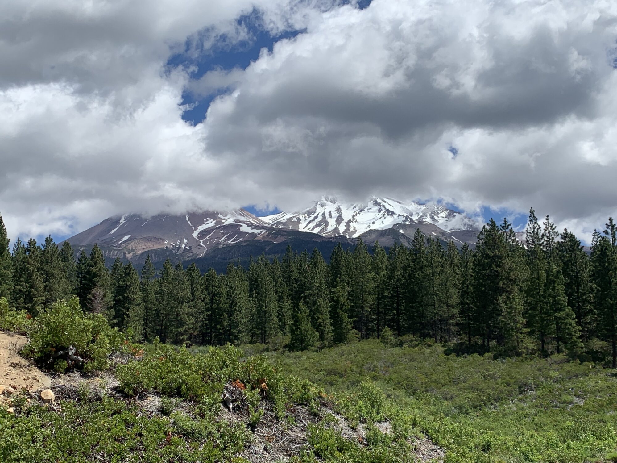
We took the morning easy and decided to explore one of Mount Shasta’s most classic half-day hikes: Gray Butt trail, which should have offered great views.
Only the spectacular road up the mountain was blocked at Bunny Flats at an elevation of 6880 feet (Did you know Mount Shasta is 14,770 feet, nearly 5000 Meters?). By the advice of the local ranger, we decided to hike the first part of the summit trail to Horse Camp, a steep ~1000-foot elevation (where we could find the last patch of snow at that level) over 1.8 miles. The trail mostly climbs between the woods, with a couple of opens that allow you to see the view. To see the great views of snow-capped ridges ahead. We had to continue another 10-minute climb up the trail, where we got into the alpine desert, and the trees did not block the wide-open views. Ran loved the hike, was excited by the views, and ranked the trail 4+ stars. Yet Keren and Ruti debated if they would rank this trail 1 or 2 stars: “too much effort for too little reward” they claimed. On the way back, we got some info about other hikes in this area – Apparently, the gate in the road of Mount Shasta up to ~7500 feet will open on June 30th, and the rangers said the most spectacular trail will be the South Gate Meadow trail. We will be back. Castel Lake is another regional favorite trail.
Back at the Flowers Campground, Keren and Ran went to swim in the McCloud Middle Falls. That was hands down the highlight of the day. Cold, refreshing water, and great memories from a good swim in beautiful falls.